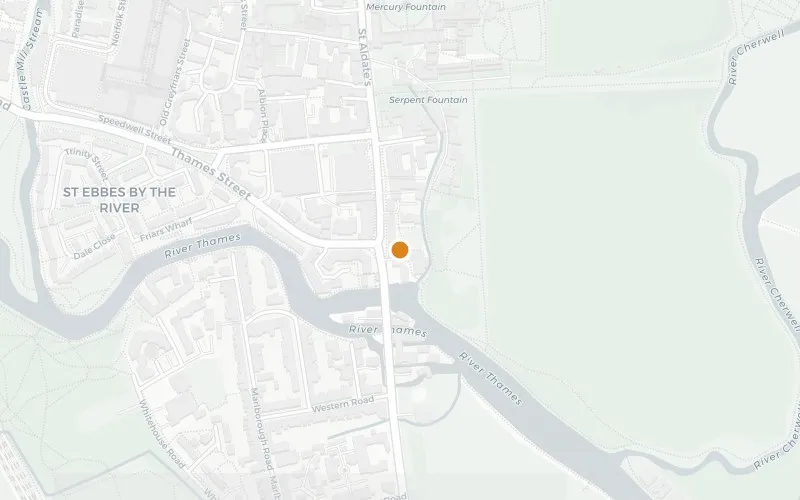
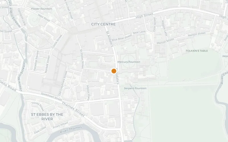
St Aldate's runs south from Carfax — the generally acknowledged centre of Oxford — down to Folly Bridge over the Thames (or Isis), and continues south through Grandpont where it becomes the Abingdon Road (A4144), heading directly out of the city toward Kennington and Abingdon. The street is named after Saint Aldate, and was formerly known as Fish Street.
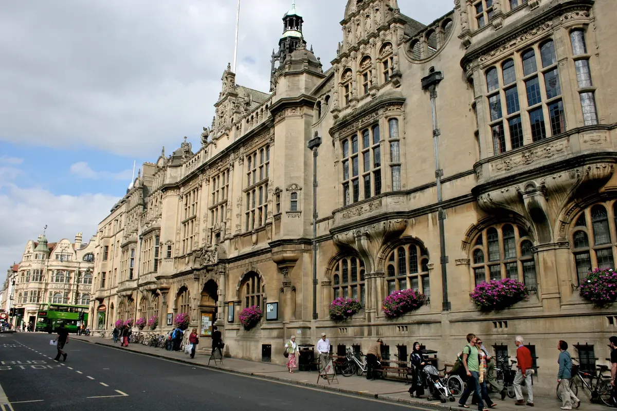
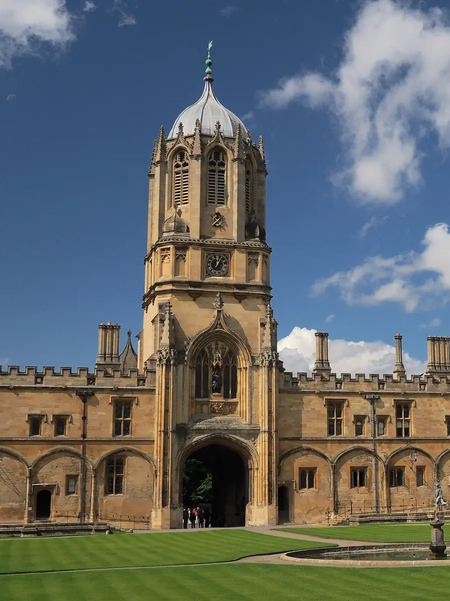
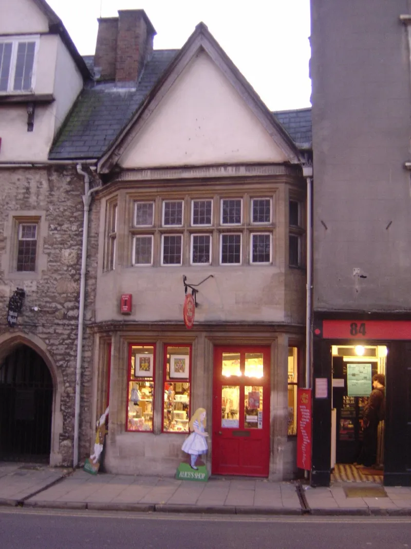
The east side opens with the Town Hall, which contains the Museum of Oxford, and runs down to Christ Church, whose great gate Tom Tower faces the east end of the street. Opposite Christ Church is Alice's Shop, the small grocer's frequented by Alice Liddell and the model for the Sheep Shop in the "Wool and Water" chapter of Through the Looking-Glass. The west side belongs to Pembroke College and St Aldate's Church, both on Pembroke Square. Further down at Nos. 86–87 stands the Old Palace, a Grade I listed early-17th-century three-storey timber-framed range incorporating earlier work, now the headquarters of the Oxford University Catholic Chaplaincy.
South of Christ Church, on the east side, an entrance leads into Christ Church Meadow, with the University's Faculty of Music alongside — the building was opened in 1936 for St Catherine's Society and houses the Bate Collection of musical instruments. Opposite, before the junction with Thames Street, stand the Combined Court Centre (Henry Smith, 1932) and the police station (H. F. Hurcombe, 1936). At the foot of the street, the Head of the River and the punt stations on Folly Bridge mark the start of the riverside walks south to Iffley.
Historical names: Fish Street
Sources:
Wikipedia: St Aldate's, Oxford · OpenStreetMap · Historic England — Oxford Town Hall (Grade II*)